


area
Q 14description
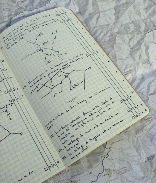
The main trail to the Yar La from the south follows the left bank up to the altitude 4800 m (approx.) and then switch to the right bank to reach the pass.source
Guy Ducrey (personal communication)map
subset
Subset of the Ladakh & Zangskar Map Series
© Olizane 2009